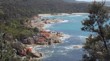
The Bechuanaland Protectorate
Okay, if you've been reading the previous pages, we've been getting a bit ahead of ourselves. Let's just pop back to the 1880s. By then, the Batswana were facing incursions from Ndebele people from Matabeleland, threatened incursions from the Afrikaners and Griqua in the south, and incursions by German colonialists from the west, from what is now Namibia, and who were also now settling in Tanganyika, the mainland part of what is now Tanzania.
Passing along similar routes came Christian missionaries, for better or worse, eventually forming what came to be called the Missionaries’ Road through the London Missionary Society mission stations of Griquatown and Campbell, north through Kuruman to Kanye (no, not the rapper) and around Molepolole, to Shoshong. From there, further wagon roads ran to Ngamiland (around Maun), the Zambezi (Victoria Falls), and by way of Tati (around Francistown) to around Bulawayo.
As already noted, the Batswana were organised into eight basic merafe (tribal groups, plural of morafe) – the Bakgatla, Bakwena, Balete, BaNgwato, BaNgwaketse, Barolong, Batlokwa, Batawana, and Bahurutshe.
Three of the kgosi (kings/chiefs) of these merafe, Khama III of what appears to have been by now the largest morafe, the BaNgwato (also bamaNgwato), Bathoen I of the BaNgwaketse, and Sebele I of the Bakwena (or Bakwana, or Kwana, or Koena, or Bakoena) approached the British to ask for protection.
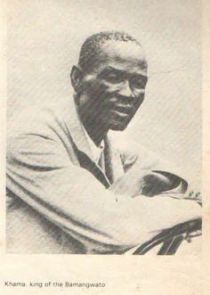
Khama III. I am unsure of the date. Sadly, I've not been able to find an early photograph of Bathoen.
|
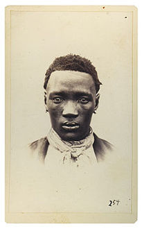
Portrait of Sebele in his twenties taken by German anthropologist Gustav Fritsch at Ntsweng (nowadays, Old Molepolole) in 1865.
|
Consequently, in 1885 the British created what it called Bechuanaland (Bechuana from the British pronunciation of Botswana). It then split Bechuanaland into north and south, with south, called British Bechuanaland, eventually becoming part of South Africa. North, called the Bechuanaland Protectorate, eventually came to be what we call Botswana.
The Bechuanaland Protectorate, basically stretching from the Zambesi River as far north as the land of Khama I’s Ngwato morafe (the predecessor of Khama III's BaNgwato morafe), was until 1964 administered from Mafeking, which features in several Mma Ramotswe stories, but which is apparently more properly called Maheking these days, and which was not then part of the Protectorate, and as Mma Ramotswe readers will know, is not now part of Botswana, but located firmly in South Africa and site of a great siege during the Boer War.
We presume the reason for this location outside the Protectorate was that the British did not believe there were any suitable places in the Protectorate itself to house important British personages like the blokes heading up the administration and their staff, and the small military accompaniment they had. It's also possible they wanted to highlight the difference between an occupied colony and a protectorate. Although any other difference is rather hard to spot.
In 1890, the Protectorate was extended to the Tawana and the Chobe River, at the current northern border of Botswana, leaving a really weird spiky extension of what is now Namibia and was then German colonial territory across much of the top of Botswana.
Location
|
|